


| | |
| Explore the Rideau Canal and Friends of the Rideau by following these links: |
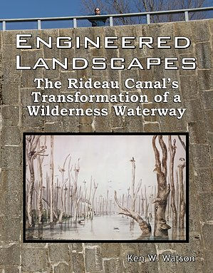 Engineered Landscapes: The Rideau Canal's Transformation of a Wilderness Waterway is a new book about the Rideau Canal that answers such questions as; what did the Rideau Route look like prior to the building of the locks and dams in 1826-1831? what did the early surveyors see? and how much flooding did the building of the Rideau Canal cause?
 Primarily a research document, the first section of the book contains a reconstruction of the pre-canal geography and includes maps and transcriptions of the first three full route surveys, those of Lt. Gershom French in 1783, Lt. Joshua Jebb in 1816, and Samuel Clowes in 1823 and 1824. The accounts of these surveys have not been previously transcribed and are presented in this book for the first time. The book then looks at the details of the building of the dams and locks, the channel engineering, and the exact levels of flooding brought about by the building of the Rideau Canal. While only 10% of the canal consists of man-made features such as locks and canal cuts, virtually every section of the Rideau has been subject to some degree of flooding. The book concludes with some information about present day field investigations that are mapping the drowned pre-canal landscape in detail.
Comments about the website email: webmaster@rideaufriends.com |